Scandinavia and Italy
Connection of gas-permeable Faults and favoured Nest Sites of Red Wood Ants in Scandinavia and Italy: First Findings
Red Wood Ants on tectonic faults
Geological findings from Southern Europe to Northern Scandinavia prove that there is a strong affinity of red wood ants for gas-permeable, young active, tectonic faults (s. Schreiber et al. 2008).
The cause of this is not resolved yet. However, there are first indications, that ascending gas from faults plays a decisive role. Those gases cause a rise of temperature in a restricted area. Formica polyctena is highly sensitive to least rises of temperatures caused by sectoral heating. Dr. Stefan Hetz, Humboldt-Universität Berlin, has proved this in a special experiment set-up. A further aspect could be that in very dry years, cavities within the faults are providing humidity near to the surface, which ants can use.
A more complex relation can be linked to the interaction of gas flow and earth-tides. The gravities of the sun and moon interfere with each other. As a result, periodic maxima of earth-tides (raise of earth crust up to 40 cm, maximum, twice a day), which are multiple of the least one (less centimeters), occur to the crust. These movements have an influence on ascending gases. Ants can possibly record these fluctuations of quality. In this case, the biological clock of ants has – besides the circadian rhythm and temperature regulation – an additional rhythm. This is advantageous for nest sites with solid blanket of snow. These sites are cut off for any length of time from outer rhythms. This very interesting aspect deserves comprehensive studies by biologists connected with the question whether there are other species, which use the rhythm of the earth tides.
Scandinavia
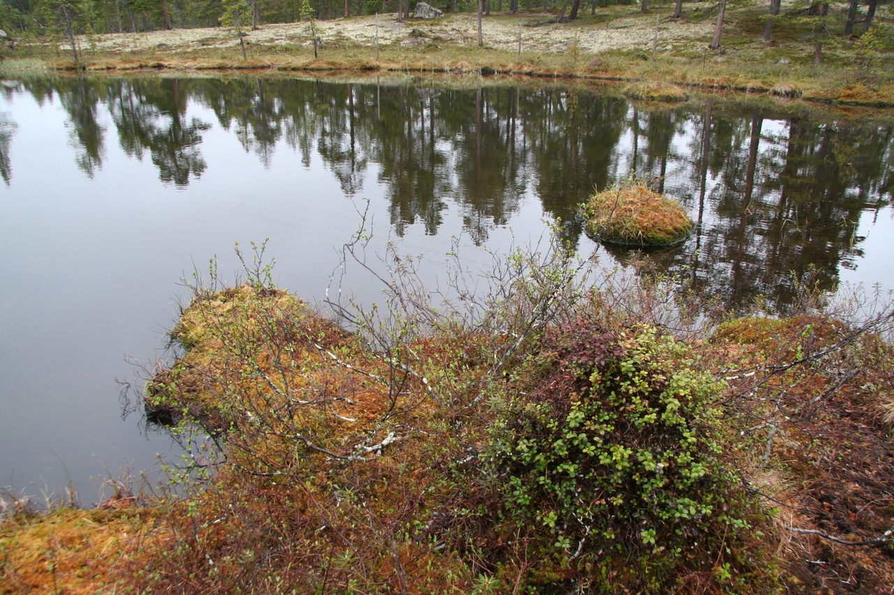
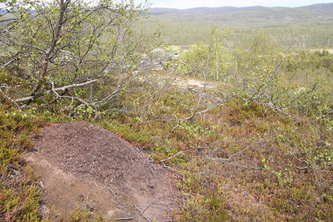
Recent investigations in Scandinavia (Lake Inari, Oslo Graben) prove an impressive connection of faults and red wood ants. Kilometers long faults penetrate the deeply eroded bedrock in the periphery of Lake Inari in Northern Scandinavia.
For there is less or no sediment on the bedrocks, gas can migrate directly from crust to surface. Based on the ecological conditions, innumerable nests developed along the fault zones up to the Barents Sea. The nest sites, directly located on the banks of numerous lakes, which can be freezed up to June, are eye-catching.
Fig: Highest nest, built in a tree trunk on NW-SE Fault in the south of Lake Inari
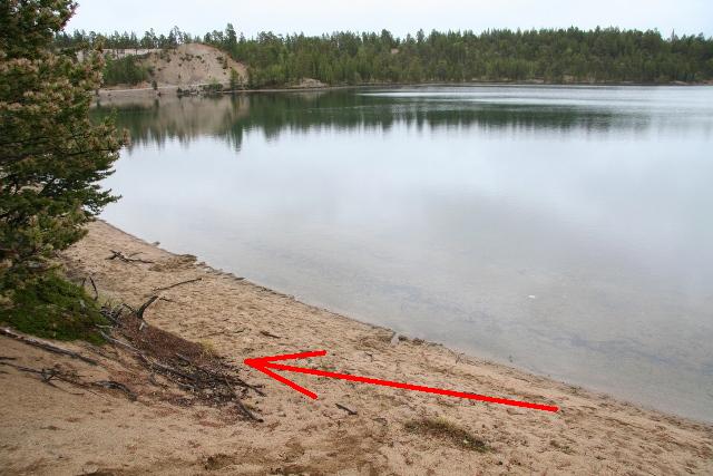
Fig. 1: Ant nest directly located on the bank of Lake Inari
On the bank, considerably accumulated amounts of gas can be detected by manually relocation of sediments. This gas can be collected quantitatively in water (referred to a defined area) without any problems. From this, conclusions about the gas flow from gas-permeable faults on continents can be extrapolated. An appropriate research project will start in 2010.
In the Oslo Graben Permian vulcanites with large thickness are widely spread. The former paths of the melts are still open today for ascending gases. The same connections can be recognised in North Scandinavia.
Fig: Nest on the summit near the metamorphic dyke
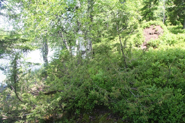
Fig. 2: Ant nest at the Lake Retthelltjärn, East of Sundvollen, 40 km North-West of Oslo
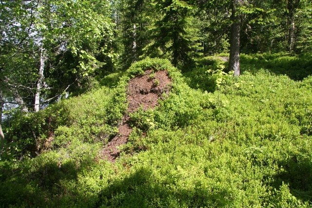
Fig. 3: Same nest at the Lake Retthelltjärn, more detailed
Gain of Knowledge for Geology
The connection of red wood ant sites and gas-permeable faults provides manifold applications within geology. Besides the prospection of gangue ore deposits, open faults systems can be localized which carry nitrogen, carbon dioxide and hydrocarbons.
For fundamental research the quantitative collection of gases origin from the crust and specially the amount of carbon dioxide are of particular interest.
This knowledge is very special for catastrophe precautions. With the help of ant nests, sites for installing monitoring stations can be identified. These stations will detect changes inside the deeper crust, e. g. rising magma, change of stress that can lead to earthquakes (see below).
Danger of Earthquakes and Measuring Methods
For the discussion of the right monitoring station sites, which detect continuously geogenic gases (helium, radon, carbon dioxide), microseism and current flows, the knowledge of open (gas-permeable) deeply reaching faults zones is of particular importance.
From these positions, changes within the parameters can directly be correlated with processes into the deep.
For red wood ants have a strong affinity to gas-permeable faults, there will be a good chance to choose appropriate monitoring sites with a direct “information channel” reaching into the deep.
A dense grid of monitoring stations should allow more precise predictions about changes within the crust. Based on the information it might be possible to inform about the probability of a short-term earthquake.
Future investigations have to prove, what kind of variability precursor phenomena show depending on the nature of the earthquake.
Earthquakes are caused by sudden movements at faults. The following movements can be distinguished:
1. Normal fault (e. g. edges of graben)
2. Thrusting fault (e. g. compression caused by plate tectonic)
3. Strike slip faults (slipping of crustal blocks, e. g. San Andreas fault)
4. Additionally, there are movements at faults of type 1 and 2, combined with strike slip faults
Increasing stress before a break leads to micro fractures in deep crustal rocks (in the periphery of the future seismic centre) just before an earthquake occurs. At the same time, existing fractures are closed partly or completely. Changes of gas flows are explained by these mechanisms. Gas permeable faults/fractures appear in different spatial positions in relation to the surface within the bedrock. At strike slip faults vertical paths exist, which can penetrate the entire crust. Through this, optimal conditions for gas migration resp. gas monitoring are given.
A different situation arises at faults of type 1 or 2. Permeabilities to the surface are linked to small accompanying faults of less importance. It is expected, that signals will become less apparent.
Depending from the type of the fault very different precursor phenomena are to be expected. Their interpretation has to be analyzed in long-term studies for each area.
Within the deep crust, a variety of processes is causing the dissolution of quartz. The quartz solution penetrates partially open fault systems, where the quartz recrystallizes. Deeply eroded layers of bedrocks give evidence. Here one can find large quartz dikes, formed over a long period.
The uniform crystallisation of quartz in one direction produces a charge displacement within the crystal lattice (piezoelectric effect) caused by tectonic stress (compression) within the bedrock.
Through this, high electric potentials are created, which are relieved per current flow at the same time. These current flows should be measurable just before an earthquake hits a region.
The Situation in Italy
In 2009, L’ Aquila region was hit by a large earthquake. Though it was only a magnitude 5.8 earthquake, it caused tremendous destructions of the old buildings and fatal causalities. (Roermond was hit by a magnitude 5.9 quake in 1992).
In Italy, the tectonic situation is very complex. Within a transition zone, where two large plates move against each other (Africa, Eurasia) subduction processes combined with compression (Appennine area) or extension (Thyrrhenic Sea) took place.
In summer 2009, random sampling inspections were carried out in the L’Aquila region in direction of the adjacent national park of the Abruzzi, in the Southeast of L’Aquila. The objective was to verify, whether the phenomena of the connection between tectonic faults and red wood ants which were found in other parts of Europe, would also be found in the southern parts.
In the immediate vicinity of L’Aquila there could be no ant nests found on well-known faults. The reasons are urban sprawl and farming. However, the region in the south of L’Aquila with its higher topography was suitable for investigations.
On the camping ground at the Lake Di Scanno, situated between Villalago and Scanno, multiple nests were found in North-South direction. One of it was built directly beneath a caravan that is parked all over the year at the same place. (see Fig. 4, (33 T UTM 0405424 / 4641298)).
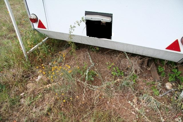
Fig. 4: Ant nest located beneath a caravan, Lake Di Scanno
The predicted North direction of the fault crosses the Lake Di Scanno. Periodic gas bubbles were observed (33 T UTM 0405253 / 4648124).
Further more nests were found in a line running up in diagonal direction the hillside outside of the camping ground (Expl. 33 T UTM 0405814 /4640557 und 0405882 /4640555).
The camping ground is very suitable for installing a monitoring station because it provides infrastructure like electrical power supply and internet connection.
At the same time, the ants’ behaviour can be monitored via real-time videos by means of an IR-camera. The objective is to register abnormalities in their behaviour just before an earthquake hits the region.
Earthquake Prediction
A “just-in time prediction” of earthquakes is not possible, following the assessment of all experts. Earthquakes are produced by many factors that are difficult to determine.
In the long run, it might be possible to predict the probability of an earthquake based on statistical investigations for a defined area. This probability will cover very long periods like years or centuries.
Characteristical parameters, monitored at several sites of an endangered area, comparable to a grid of meteorological stations, are entirely conceivable. These characteristic parameters are changes of elevation of the surface (via GPS), gas monitoring, monitoring of geophysical parameters and perhaps changes within the fauna. The choice of the monitoring sites is crucial and can be fixed with the aid of ants. In Italy – as an example – 10 to 20 monitoring stations could be positioned in the Appennine region (a region with forest and red wood ants). At these stations the entire monitoring programme could be performed.
Changes could be updated at regular intervals and documented by “endangerment maps”, which show risk-increasing alteration in special regions. Theses maps should be freely available on the internet at any time.